DISCOVERY OF THE MORTELLA WRECKS
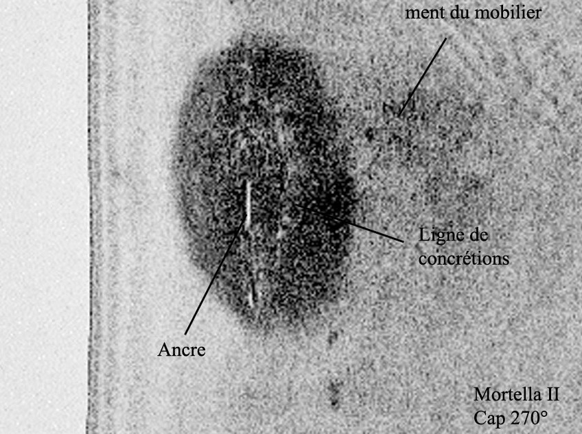
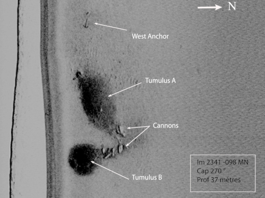
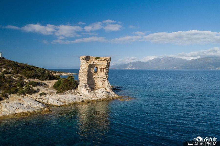
The Mortella 2 and 3 shipwrecks were discovered during a geophysical survey programme carried out as part of the development of the archaeological map of Corsica’s maritime heritage. This project was carried out between 2005 and 2008 by the Centre d’Etudes en Archéologie Nautique (CEAN) in the Bay of Saint-Florent, covering a total area of about 20 km² between the coast and 50 metres deep, using acoustic and magnetometric detection devices.
The two sites were discovered using side-scan SONAR:
– The first, called Mortella 2, was located in October 2005 at a depth of 48 metres.
– The second, called Mortella 3, was discovered in November 2006 at a depth of 38 metres, approximately 700 metres south-east of the first.
At the time of their discovery, these sites were characterised by the presence of burial mounds made up of gravel and ballast covering the remains of wooden hulls, and by the presence of archaeological material consisting mainly of artillery pieces, stone cannonballs and wrought iron anchors.
A link was quickly established between the two sites: the typological identity of the artillery and the identity of the nature of the gravel and ballast stones, revealed by petrographic analysis in 2007, proved that the two sites were part of the same historical event.
EXCAVATION CAMPAIGNS 2010-2021
Since the location of the Mortella 3 shipwreck in 2006, there has been evidence of the existence of two nearby tumulus, which could correspond to two sunken ships or belong to the same vessel.
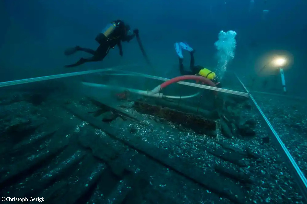
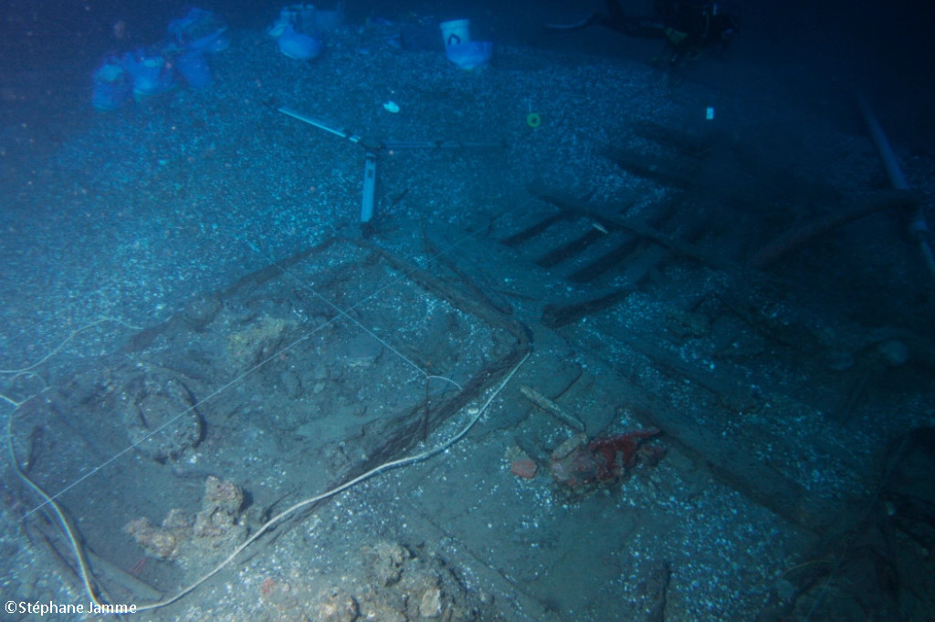
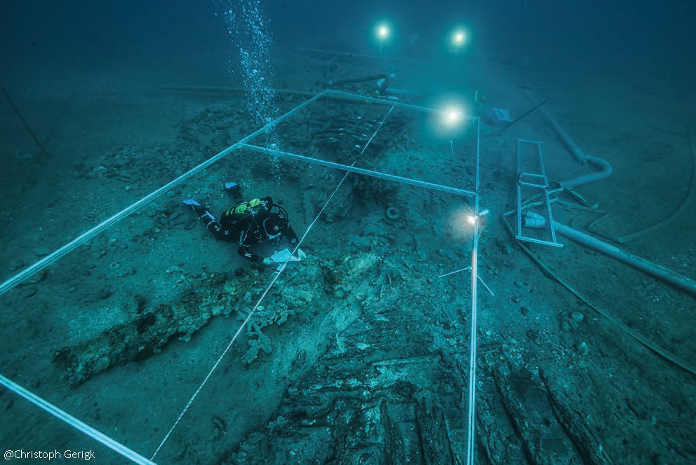
In the 2012 survey, it was found to be a single vessel that was split in two lengthways. The two parts separated before reaching the seabed, perhaps as a result of the shock wave caused by the stern of the ship hitting the seabed, thus explaining the presence of two tumuli. This is unusual, given that ships are usually found resting on one side.

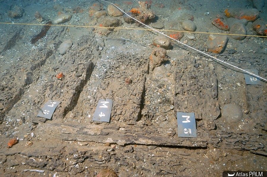
The first remains of the hull found correspond to the burnt ends of some frames that leave no doubt as to the violent fire that consumed the ship before it sank. The paucity of archaeological artefacts present at the site attests to the fact that it is likely that the crew abandoned the ship, taking what they could with them before setting it on fire.
The most representative finds were the wrought iron artillery, nine tubes and eight butt chambers scattered around the site, and numerous stone projectiles; the ropes, found in large quantities and partially burned in the bow area of the ship; and finally the pottery on board, found very fragmented and also altered by the heat in the stern area.
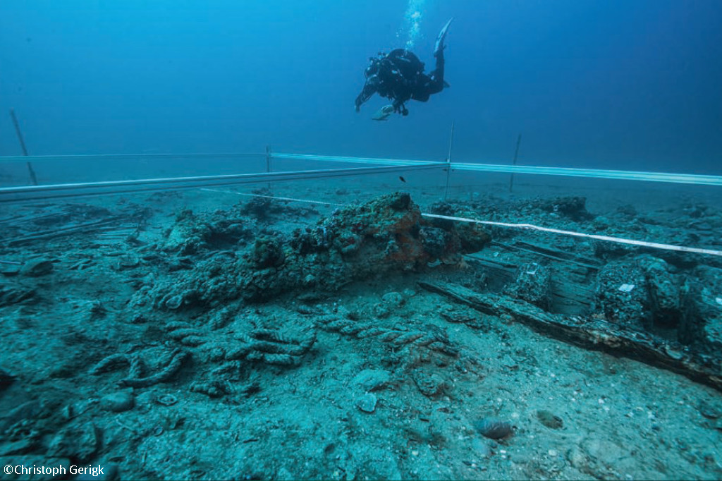
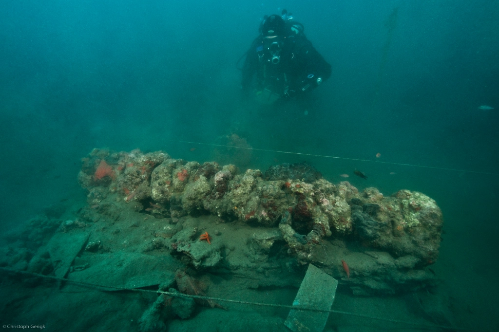
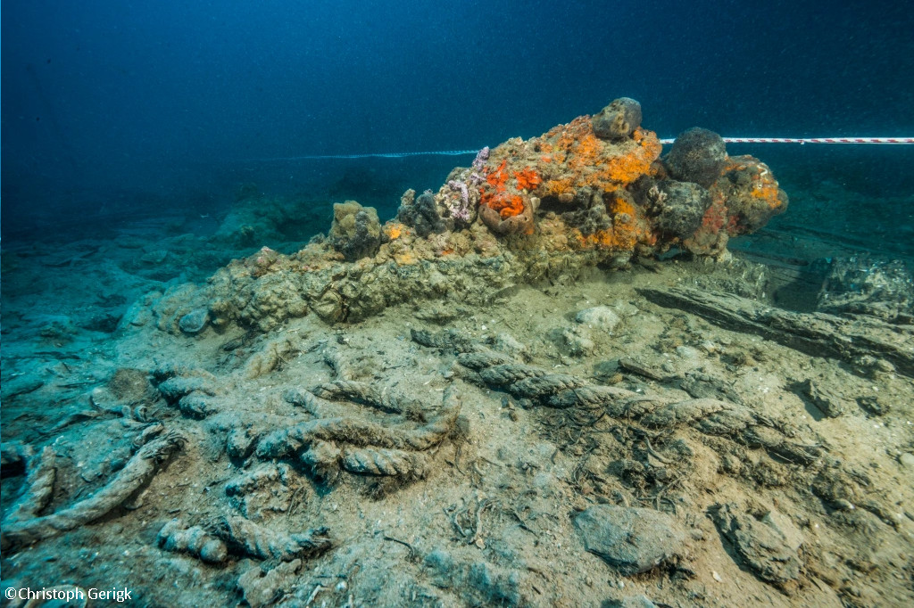
In the case of the Mortella 2 wreck, it should be noted that the layout of the site, although smaller than the Mortella 3 site, has striking similarities with the Mortella 3 site:
- The orientation of the two shipwrecks is similar, with a general east-west axis.
- The distribution of the artefacts is also similar: the ceramics are essentially scattered in the eastern part of both sites, which in the case of Mortella 3 corresponds to the stern area. This archaeological evidence is, in fact, logical, as the living and cooking areas were located at the stern of the ship.
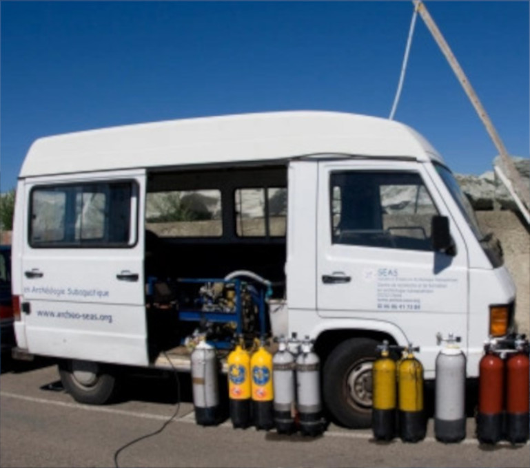
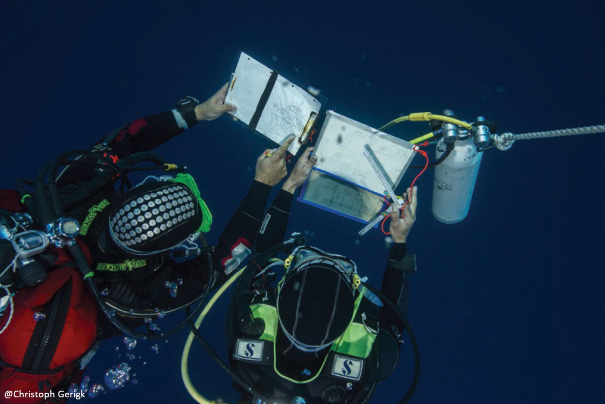
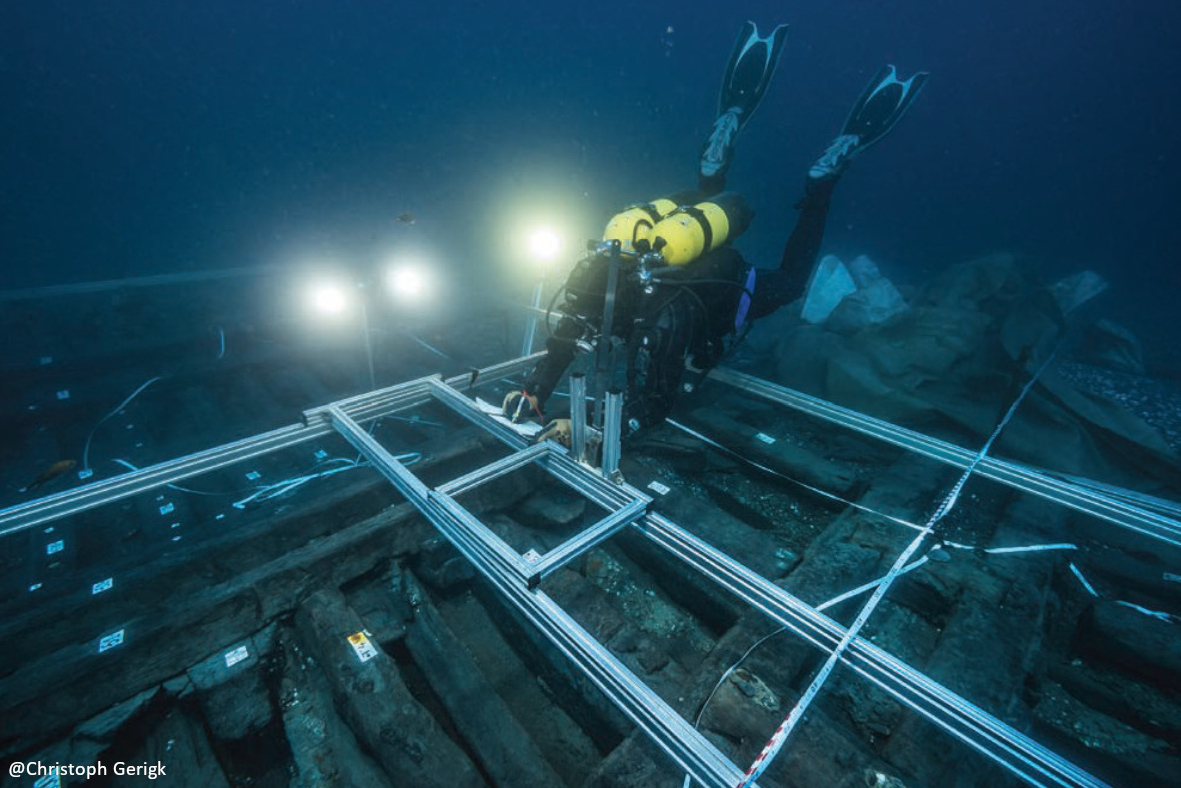
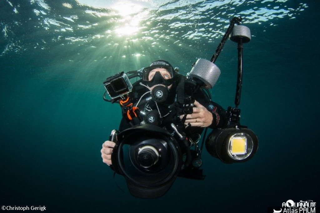
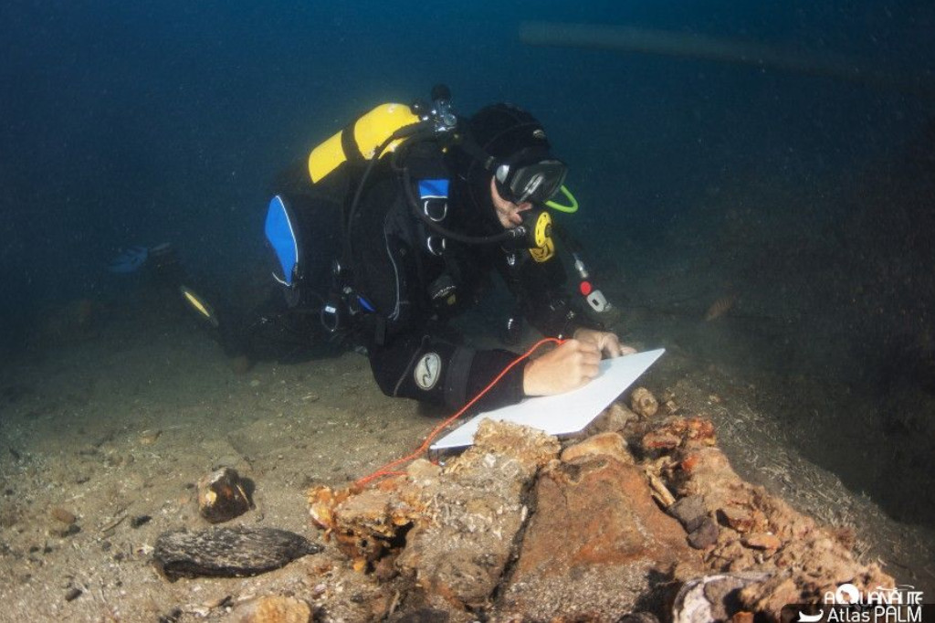
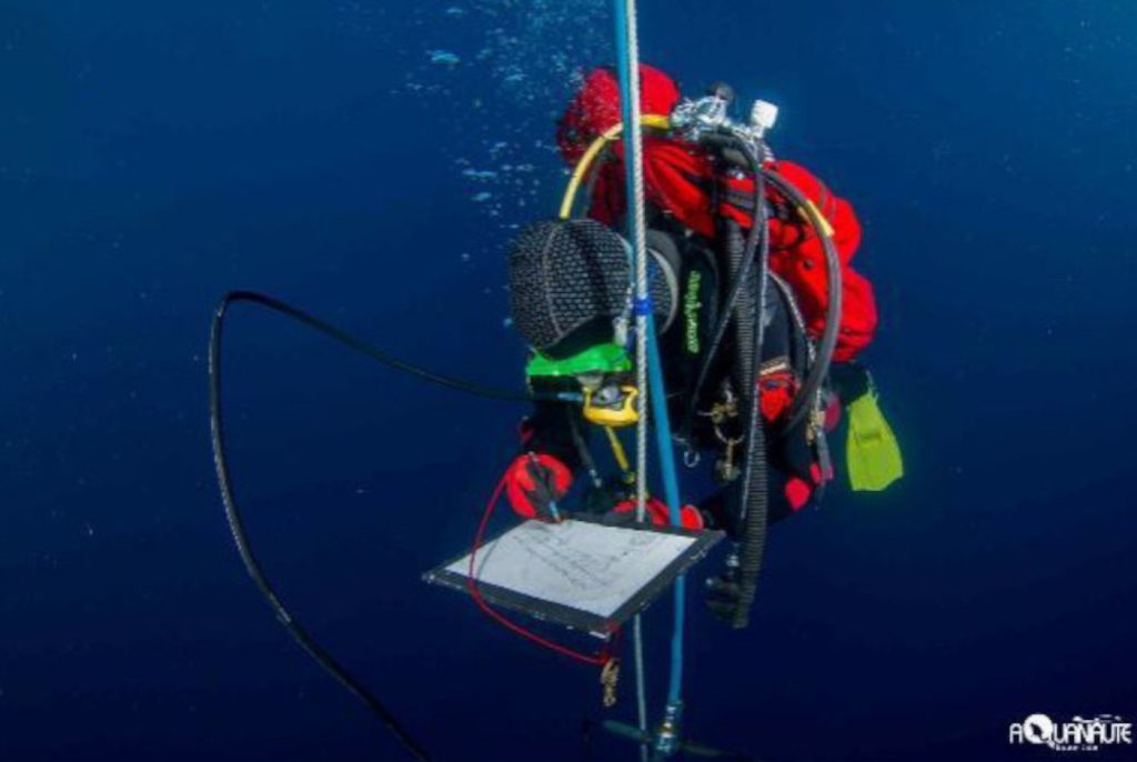
From a practical point of view, it must be stressed that the technical and logistical organisation of this excavation at a depth of almost 40 metres is a complex and costly operation. At this depth, a major constraint is the very short intervention times (maximum 50 minutes per diver per day), which means that large teams must be assembled to ensure the number of rotations necessary to complete the archaeological work. Ensuring the safety of the divers is also a major concern, imposed at this depth by the need for long decompression stops.
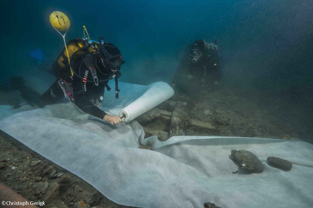
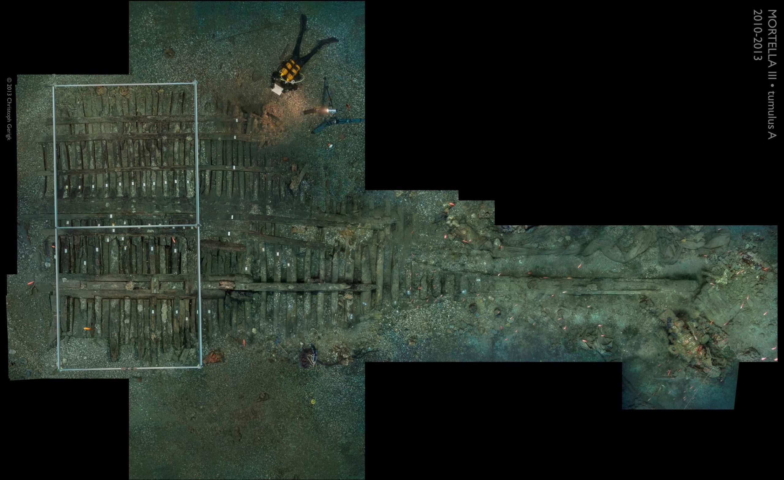
Finally, in order to ensure the good preservation of the remains of the excavated areas that are uncovered each year – an area of about 20 to 30 m2 per season – it is essential to rebury them. They are covered with a sheet of geotextile at the end of the excavation, followed by a layer of sediment to create an anaerobic environment to ensure the preservation of the remains, particularly the organic matter. From a methodological point of view, it should be added that the understanding of the organisation of the site and its study were greatly facilitated by the creation of a photomosaic made up of a multitude of photographs. It has been completed year after year and, in order to obtain a working document to scale, it has undergone meticulous post-processing to correct lens distortions and align the images with our topographical surveys.
The archaeological campaigns have been described chronologically since 2010. For this reason, some descriptions present hypotheses that have evolved and/or been discarded over time.

2010 Campaign
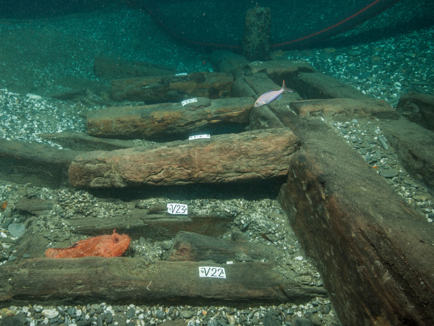
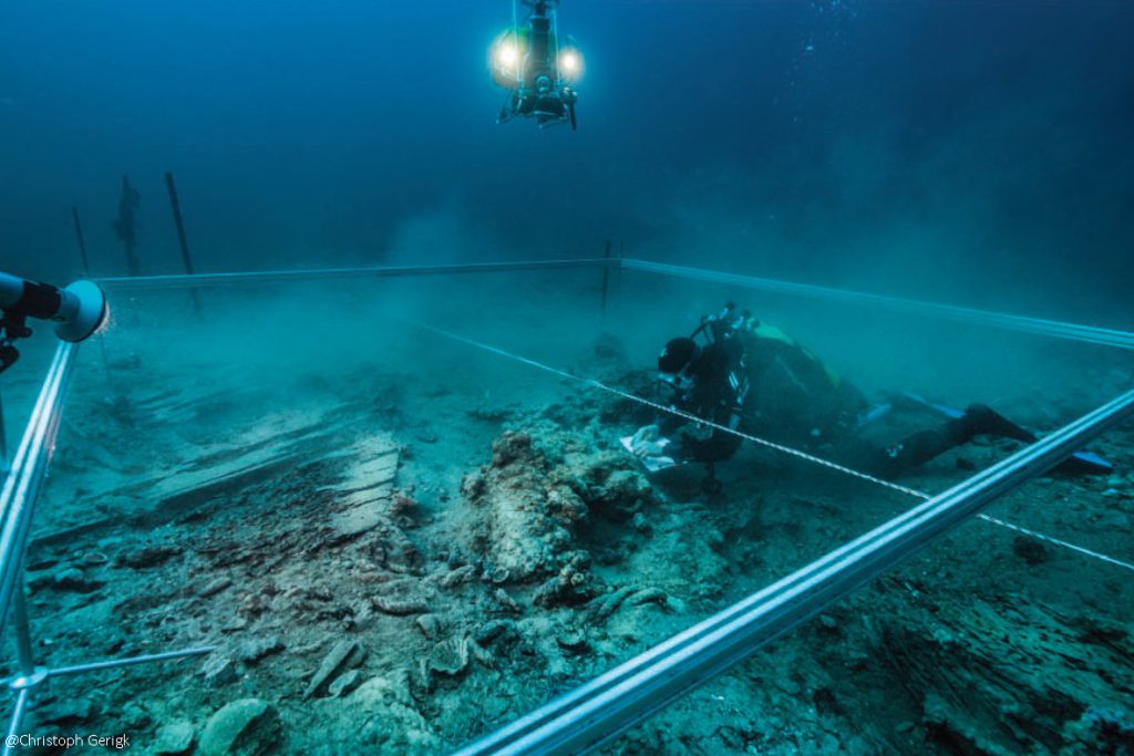
The excavation of the shipwreck began during this season. It consists of two distinct archaeological complexes: the first is represented by a large tumulus (tumulus A) approximately 35 m long and 12 m wide, while the second, tumulus B, is smaller, 20 m x 10 m; both tumulus converge and are located in the northeastern part of the site. They rise just over a metre above the general bottom level and are covered with a thick layer of ballast gravel and river stones that conceal the remains of the vessel. The observation of the charred extremity of the frames at the level of a part of the first bindings leaves no doubt as to the violent fire to which the ship was subjected before it sank.
One of the priority objectives of the 2010 excavation campaign was to observe the construction techniques used in order to advance, if possible, the first hypotheses about the origins of the vessel. The aim was also to determine the nature of the remains located under tumulus B and to try to determine whether they were linked to those of tumulus A or whether they were independent and probably housed a second wreck.
Diving will not begin until the second week (14 September). First the site was photographed and filmed, then the wreck was cleaned. The first remains to come to light were several cannonballs which, together with the charred wood, suggested that a fierce naval battle had taken place on the site.
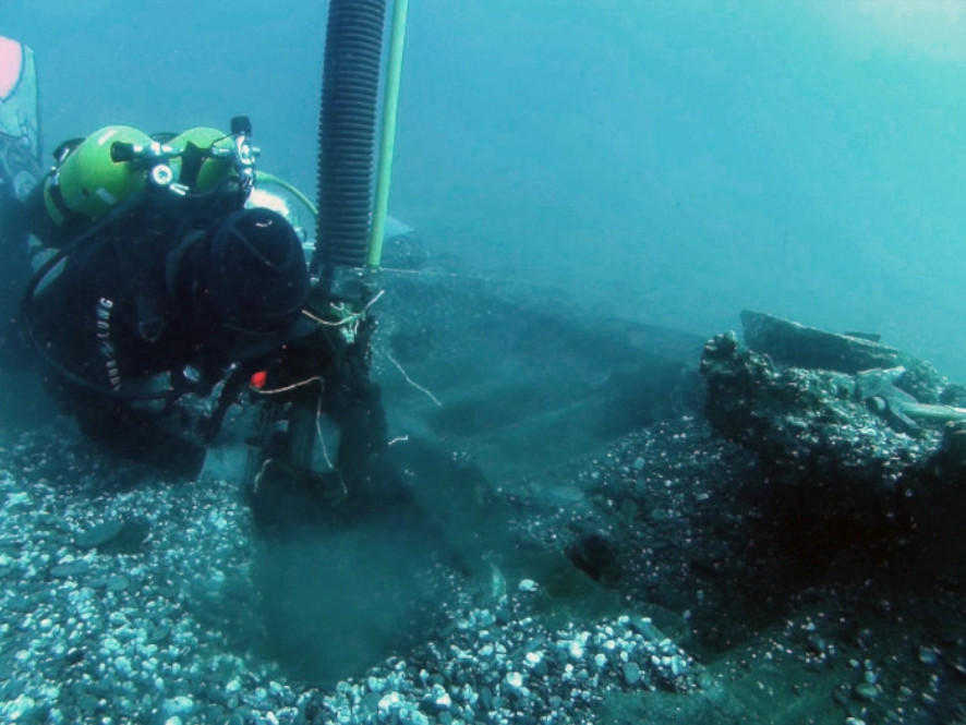
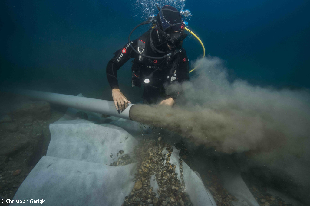
In the following days (15-19 September), the work continued slowly, with the motor pump removing the sediment composed of gravel, and the first glimpses of the ship’s hull began to appear.
Work is continuing on the extraction of the sediment covering the wreck, which is poor in archaeological material, with only a few fragments of pottery.
The structure of the nave and the remains of burnt wood begin to show, which speaks of the reasons for its collapse.
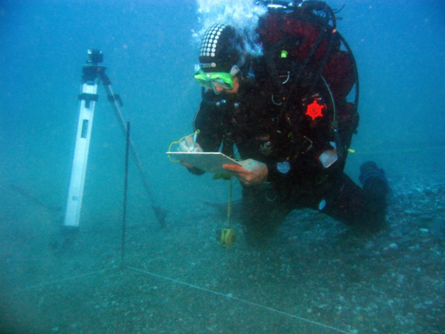
The documentation of the remains, both with photographs and drawings, is multiplying.
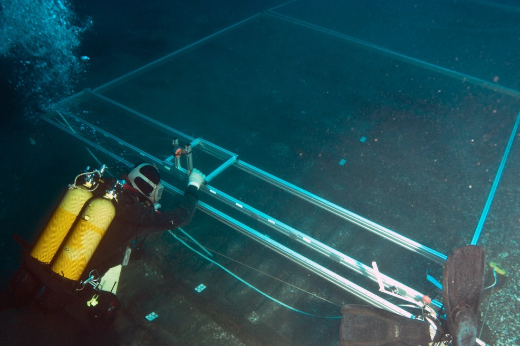
In parallel, a new survey is opened in tumulus B, assuming that it could be a second wreck.
During the fourth week, the shipwreck is practically excavated and it is possible to comment on the work to document the construction techniques used to build the ship.
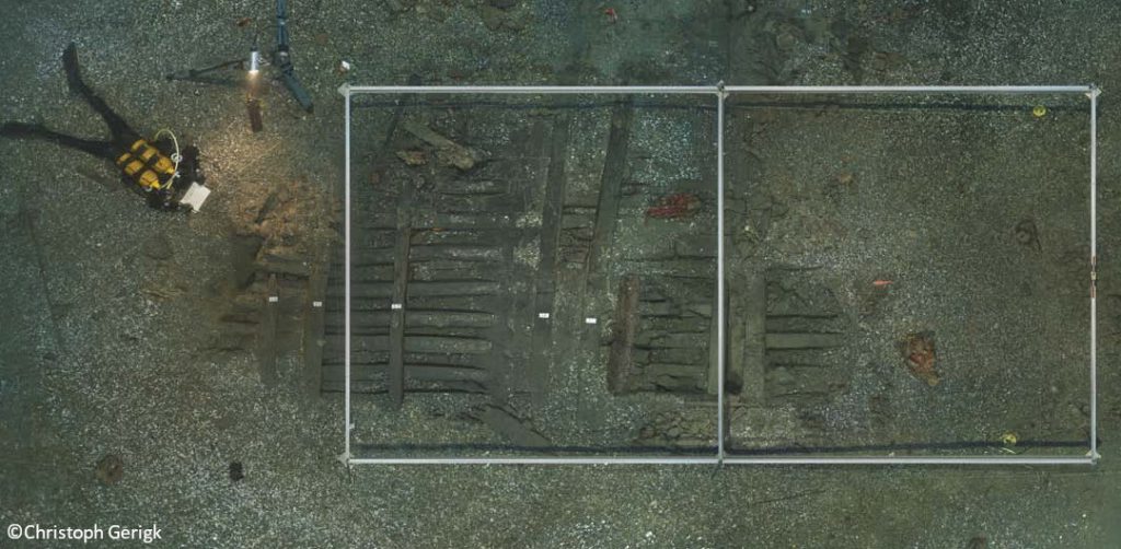
In the fifth week, work focused on tumulus B at Mortella 3. The first results indicate that the wreck is different from the one excavated in tumulus A.
The excavation of the ship continues, and samples are taken for dendrochronology.
During the last week, the excavation work of this season was completed and the site was protected.

2012 Campaign
The main objective of this campaign was to gather the necessary information to be able to reconstruct the structure and geometry of the wreck, as well as the construction methods and techniques used. At this time, the possibility that it was a large Mediterranean ship from the 16th century was already being considered.
In order to meet the objectives, a complete study was carried out of the remains of the wreck, as well as of the artillery and on-board equipment found. Given the size of the site and the size of the areas to be excavated to achieve these objectives, it was estimated that a minimum of three missions would be necessary.
The discovery of a single vessel broken longitudinally along the port end of the spars was the most significant result of this campaign.

As in the first season, the first week of the season was focused on logistical questions about the future excavation. Spaces were prepared for the storage of the material, anchors were fixed to the seabed to stabilise the motor pumps and a 25 m² test pit was prepared in tumulus B.
The second week of excavation was mainly dedicated to two tasks, the excavation of an area of 25 m² in tumulus B and the cleaning and removal of the geotextile from the excavation area of the 2010 campaign.
Day by day, the wooden structures that quickly appeared in our excavation area of Tumulus B are becoming more coherent. At last, one of the major questions of our 2012 mission has been answered: tumulus B contains the port side of the ship located under tumulus A. The reasons for the longitudinal rupture of the ship are unknown at this stage, but everyone agrees on the violence of the event, either due to the explosion of the santabarbara or the collision with the seabed.
In parallel, work on the tumulus A is progressing at a good pace. Structural parts of the ship continue to be uncovered, such as the keel and the mainmast’s gripping system.
The rooting system of the main mast in question is very similar to the one observed on the Lomellina wreck by Max Guérout’s team (GRAN). At the same time, we are certain of the Mediterranean origin of the wreck, a second important question of our mission which has been answered.
At the same time, a detailed study of the composition of the gravel and ballast stones is being undertaken. A basalt stone, another element linking our wreck to Italy, is of particular interest. It could link the ship to its origin in Italy and more specifically to one of its ports close to a volcano, Naples, Catania…
2013 Campaign
During this campaign, the excavation was mainly located in two sectors of about 20 m², situated on the bow side of the wreck, in the southwest part of the site, and on the starboard side at the foot of the main mast. The aim of the excavation of this sector is essentially to answer problematic questions concerning the proportions of the ship, in particular the size of the keel, to be able to obtain a complete section and to know the general proportions of the whole structure derived from this.
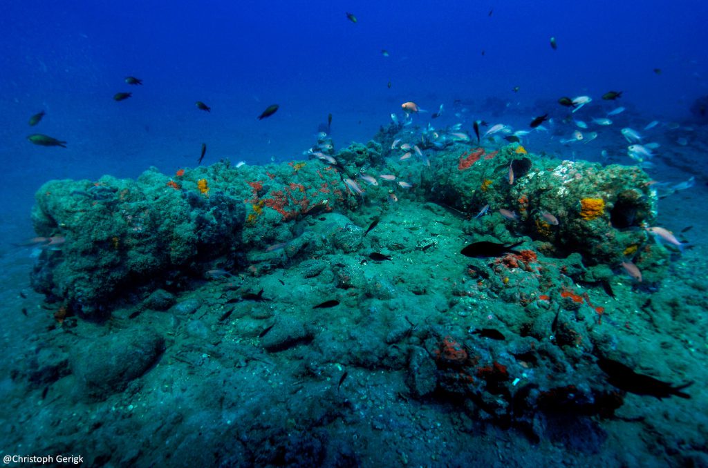
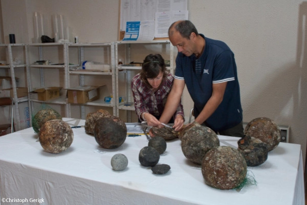
The first dives revealed well-preserved pieces of wood and the remains of ropes. Several small cannonballs made of volcanic rock, probably of Italian origin, were also discovered on the starboard side of the keel. A new wrought iron cannonball with a ringed barrel was also documented. We have three different categories of cannonballs: those found this year are 12.5 cm in diameter, while the large calibre ones are between 15.8 and 22.4 cm. Each size corresponds to a weight of 1-1.5 kg, 6-7 kg and 16-17 kg respectively, the variation in weight being due to the type of stone used.
As in previous campaigns, the first few days were spent reconditioning the boat, repositioning the mooring and removing the covering and sediment that had been deposited on the wreck.
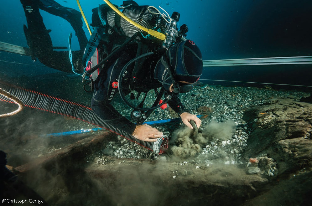
As the excavation progresses, we continue to find numerous remains of ropes, preserved in concretions or partially charred. These show all the classic characteristics of the common and inactive manoeuvres of a ship. During the excavation phase, it is known that the keel measures 26 m, so it can be deduced that this is a vessel of more than 35 m in overall length with a width of 10 to 11 m at the main beam.
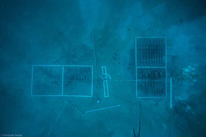
To facilitate sounding and photomosaicking, the bow guns are removed and the visible parts of the wreck are cleared. In the harbour, two grids are prepared to allow the transversal soundings to be carried out.
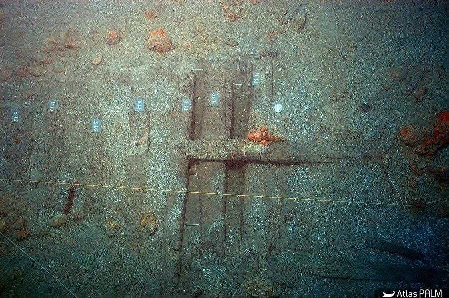
As the days go by, the mesh in both excavation areas are under water, while the survey of the two excavation areas continues. In one of them, a new important discovery was made: on the starboard side, we found the main frame of the ship, specifically hatch n° 27. This was a second objective of the mission, to determine the section and work on the question of the width of the ship, to reflect on the question of the size of its plan and, finally, to draw conclusions about the shape of the ship.
At the beginning of the week mercury is found in one of the excavation areas. Mercury was mainly used in the gold and silver mining process of the time, but it is also attributed with medicinal functions, such as the treatment of syphilis and scabies.
Longitudinal and cross-sections of the two excavation areas are made and final observations are made on the construction characteristics of the framework, the connections and the methods of assembling the wooden parts.
The last few days are devoted to reburying the site. The excavation areas are covered with geotextile fabric and the suction machines are reversed to deposit a layer of sediment. This is an essential condition for the good preservation of the site.
2014 Campaign
The 2014 campaign was carried out with limited financial resources and the objectives of the work were therefore adapted to the excavation area that had already been explored. In fact, it would have been impossible to open up a new area of excavation with the subsequent removal of the ballast gravel with the resources that we had at our disposal.
The rapid access to the remains made it possible to organise the partial dismantling of some of the hull structures. In particular, the study of the M27 structure was carried out on dry land. This allowed us to deepen our knowledge of the ship’s typology, construction processes and techniques.


The work on piece M27 has allowed us to draw the following conclusions:
- We are looking at a ship whose main hull is equipped with a fairly high bottom, which contrasts with the Red Bay ship (1565), for example, and testifies to a relatively deep draft. The shape of the hull of Mortella III is very round: there is no inflection at the points of the shields of the middle frame and, consequently, the bilge is not marked. It follows an arc of a circle with a radius of 5.65 meters, almost perfectly circular. From this point of view, the design of the bottom of the Mortella III wreck is similar to that of the Villefranche-sur-Mer wreck (1516), which has the same characteristics, with a single circular arc up to the waterline area. Above, although we do not know how this line evolves in the case of the Mortella III, due to the lack of remains, we do observe that it follows a curve with a radius half that of the first in the case of the Villefranche-sur-Mer.
- The width is between 10 and 11 meters. This measure allows us to correct the 2013 estimates, which were based on a lower value. This order of magnitude now defines the proportions of a vessel with a beam to keel length ratio of between 1:2.27 and 1:2.50. These proportions, although superior to the Ace-two-three rule that governed the construction of merchant ships at the time (and to which the Red-Bay wreck conforms), are still in line with the examples we have in the Mediterranean.
On the other hand, the second area in which progress was made during the 2014 campaign was in the knowledge of construction techniques and methods. Thanks to the analysis of the M27 frame piece, it was possible to observe in detail the ways of assembly and union of the pieces of the transverse frame, and to confirm and clarify the processes described in previous campaigns.
Work on piece M27 has allowed us to draw the following conclusions:
- We are dealing with a ship whose main hull has a relatively high bottom, which contrasts with the Red Bay ship (1565), for example, and indicates a relatively deep draft. The shape of the hull of Mortella III is very round: there is no bend at the points of the shields of the middle frame, and consequently the bilge is not marked. It follows an arc with a radius of 5.65 metres, almost perfectly circular. From this point of view, the design of the bottom of the Mortella III wreck is similar to that of the Villefranche-sur-Mer wreck (1516), which has the same characteristics, with a single circular arc up to the waterline area. In the case of the Mortella III, although we do not know how this line evolves due to the lack of remains, we can see that it follows a curve with half the radius of the first curve in the case of the Villefranche-sur-Mer.
- The width is between 10 and 11 metres. This measurement allows us to correct the 2013 estimates, which were based on a lower value. This size now defines the proportions of a ship with a beam to keel ratio of between 1:2.27 and 1:2.50. These proportions, although superior to the ace-two-three rule that governed the construction of merchant ships at the time (and to which the Red Bay wreck conforms), are still in line with the examples we have in the Mediterranean.
On the other hand, the second area in which progress was made during the 2014 campaign was in the knowledge of construction techniques and methods. Thanks to the analysis of the M27 frame piece, it was possible to observe in detail the way in which the pieces of the transverse frame were assembled and joined, confirming and clarifying the processes described in previous campaigns.

2015 Campaign
The main objective of the 2015 campaign was to explore the bow and stern sections of the wreck, which had not yet been the subject of detailed and in-depth observations. Without ignoring the contribution that this year’s observations have made to our understanding of the remains at the forward end of the wreck, it must be acknowledged that the most significant discovery of the 2015 campaign was the discovery of a wooden panel of approximately 2m2 located aft of the heel of the wreck’s keel. The panel was quickly identified as the remains of the ship’s rudder.


The significance of the discovery of the rudder remains can be analysed from two perspectives.
- Firstly, from the point of view of the vital role that a ship’s steering system plays in terms of its functionality and nautical qualities.
- Secondly, because of the archaeological rarity of this type of remains: as far as we know, only three rudders from the 16th century have been excavated and studied in the world: those from the wrecks of the Mary Rose (1545), Red Bay (1565) and Villefranche (1512). In this sense, the similarities between the rudder of the Mortella III wreck and that of the Villefranche wreck, particularly in terms of the way the parts are attached, represent a first step towards documenting what could be a technical model in the future. The Mediterranean.
The 2015 campaign marks the end of the fifth year of excavations on the Mortella III wreck. During this time a great deal of information has been gathered, much of which is relevant to our naval architecture research. It was therefore decided to pause the excavation of the wreck in order to organise, classify, analyse and “digest” the information available.
2019 Campaign
The 2019 excavation campaign focused on the ship’s keel and stern bend, which were well preserved under a thick layer of sediment. In parallel, photogrammetric coverage of the excavation area and survey of the area south of tumulus B was planned in order to check for signs of the ship’s bow on this side of the wreck.
Wood samples were also taken and a search was made for pieces with sapwood remains in order to carry out a new dendrochronological study to complete the previous one based on only two samples.
The excavation was completed by covering the excavated areas with a sheet of geotextile, covered in turn by a layer of gravel ballast.
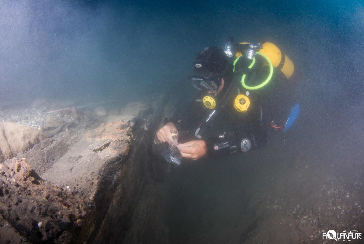
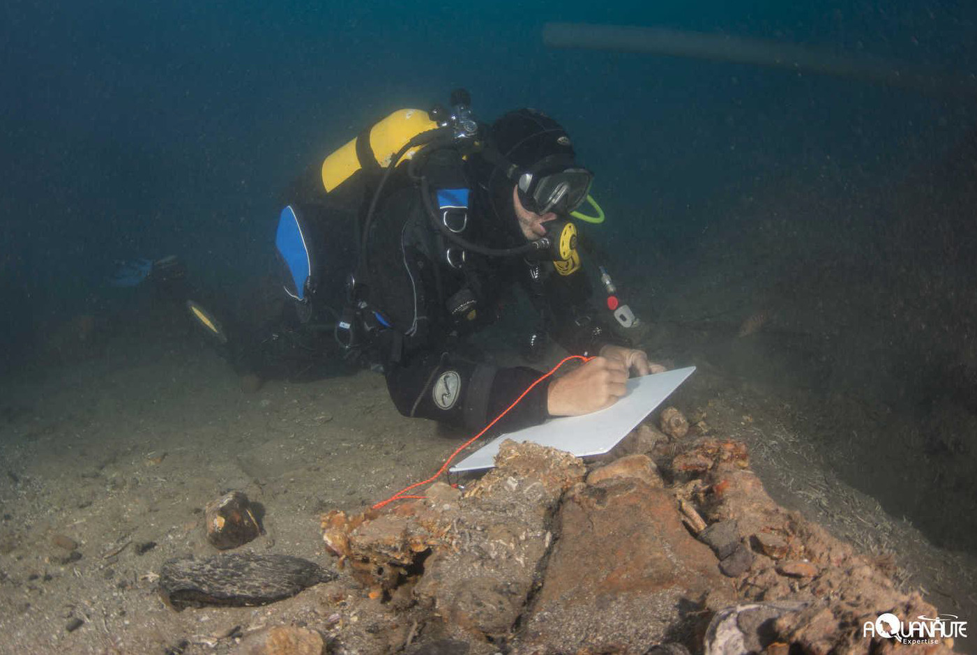

The study of the site encountered a major obstacle, namely the depth of the wreck and the operational difficulties involved in archaeological work at 47 m depth. However, it is true that its historical link with the Mortella 3 wreck and the high archaeological value it represented made it difficult to conceive of completing the Mortella project without carrying out a deep incursion into this site. For this reason, an operation was organised, but it certainly represented both a technical and logistical challenge. Despite the operational constraints and, in particular, the limited time spent on the seabed, the Mortella 2 shipwreck proved to be very rich, both in terms of the information collected on the hull remains and the contribution of its artefacts to our knowledge of the material culture of the time.
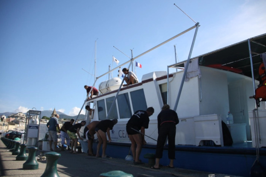
To ensure optimal safety of the operation, and taking into account the accumulation of nitrogen in human tissues, it was decided to limit the procedures to one 25′ dive per day with oxygen decompression. The dredge was powered by a high-pressure water pump (5 bar-60 m3/h) located on the U Saleccia, our operational base ship.
At the end of the excavation, the survey area was completely covered: first a geotextile sheet was placed over the debris. The dredge was then reversed to return the sediment and ballast gravels that had initially been removed from the excavation area.
2021 Campaign (Mortella 2)
Initially, the aim was to carry out a general survey of the site, to carry out a complete cartography and to precisely locate the visible archaeological remains by means of a topographical survey. The aim of this work was to contribute to the understanding of the layout and dynamics of the site, to measure its archaeological potential, to monitor it and to ensure its protection.
Another objective was to study the type of construction used on the hull. This was all the more necessary as the name of one of the ships, the Boscaina, seemed to have a possible eponym of Basque origin, so it was important to determine whether the shipbuilding tradition was of Atlantic or Mediterranean origin. The drilling that made it possible to study the wreck also provided an opportunity to take samples for dendrochronology.
Finally, the operation included a preliminary study of the artefacts visible in situ: documentation of the artillery (represented by wrought iron pipes and wrought iron chocks accompanied by stone projectiles), two anchors and the pottery located on the wreck. For the conservation of the materials studied, a preventive conservation laboratory was set up, whose protocols for action conformed to UNESCO criteria. The transport to the laboratory and the care of the objects followed the criteria inspired by the DRASSM Conservation Guide.

