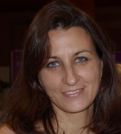
María José García Rodríguez

Dr. María José García Rodríguez is specialized in Cartography, Geodesy and Geographic Information Systems (GIS). She holds a BSc. in Land Surveying from the Technical University of Madrid (UPM), a MSc. Geodesy & Cartography and PhD. in Geodesy & Cartography, both from Alcala University.
She has worked on the DynCoopNet Project, funded by European Science Foundation (ESF) collaborating with the MERCATOR Research Group from the Technical University of Madrid (UPM). Her research was based on implementation of historic data in a Geographic Information System (GIS) in order to achieve a spatial and temporal reasoning. She has been teaching in Cartography and GIS at Alcala University and Surveying in Camilo José Cela University.
Fields of interest in her research are Geomatics, historical GIS, geovisualization, web mapping and geospatial interoperability.


